“In Rotterdam, there is still so much to be uncovered – from Stone Age traces at the Maasvlakte to medieval layers beneath the city centre.”
Amidst the high-rises and contemporary architecture, it can be difficult to imagine what Rotterdam once looked like. Only the Sint-Laurenskerk is left as a reminder of the city’s medieval past. In this route, Maaike Sier takes you back in time – revealing excavation sites across the city and the stories of what can be found beneath the surface.
Archaeologist Maaike Sier studied Pre- and Protohistory before working on excavations across the Netherlands, often tied to major infrastructure projects such as the Betuweroute, the HSL and the Westerscheldetunnel. Since 2006, she has been working in her own city of Rotterdam at BOOR – the municipal Bureau for Archaeological Research.
1
2
3
4
5
6
7
8
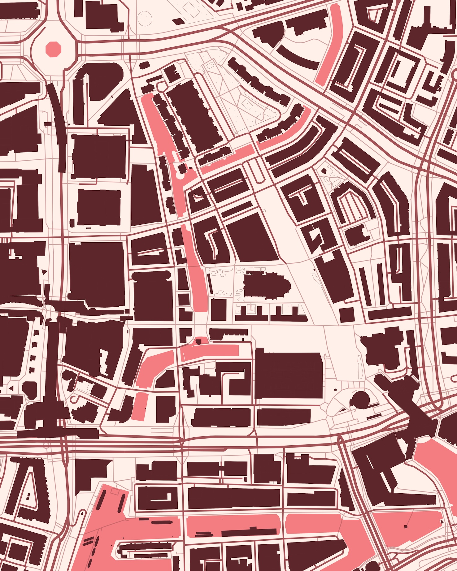
Looking north, you see a wide open stretch: the Binnenrotte. It roughly traces the course of the river Rotte, which was dammed around 1270 near today’s Hoogstraat. From that moment on, Rotterdam began to grow rapidly. By around 1300, several hundred people were living on and around the dam. In 1340, the city was granted its charter, with the Hoogstraat marking its southern edge.
By 1358, the city expanded, with the Blaak forming part of the surrounding canal. Only in the 16th century did Rotterdam gain a fully enclosed city wall. During the construction of the railway tunnel, sections of this wall – along with a tower marking the harbour entrance – were uncovered. Since the construction of the Blaak station, this tower has been reconstructed on its original site.
Back to map
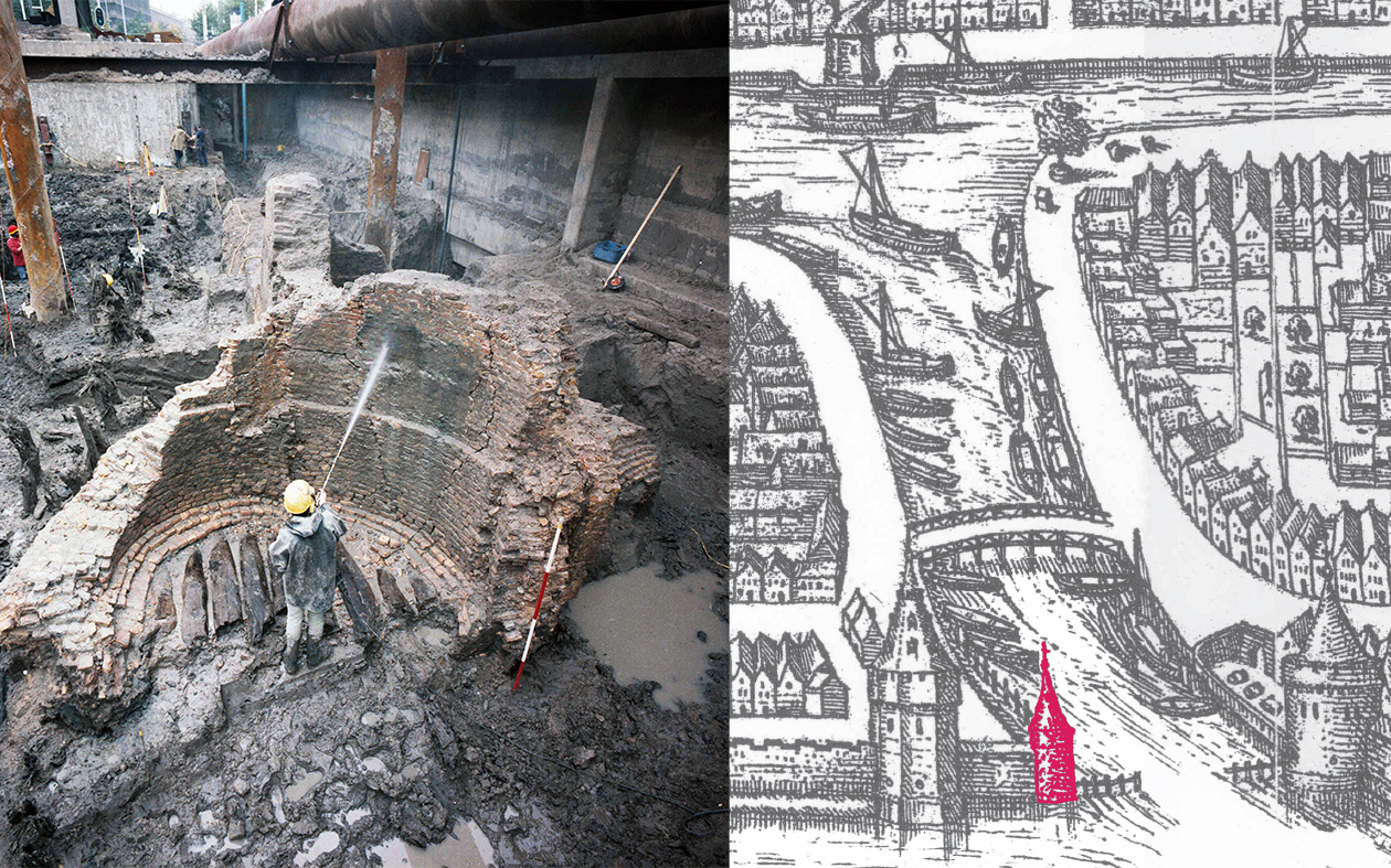
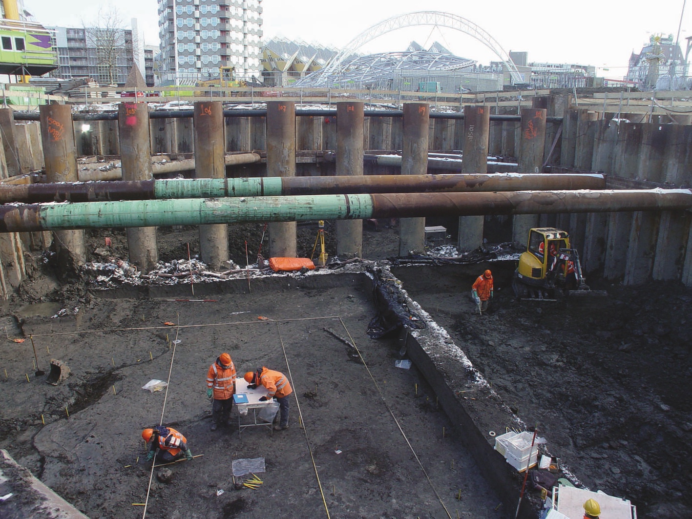
During the harsh winter of 2010, archaeologists excavated the construction pit of the Markthal. At a depth of ten metres, they uncovered remains of Rotta – the settlement that predates Rotterdam. Though first mentioned in a document from 1028, most of what we know about Rotta comes from archaeology.
Its inhabitants built their homes along the river Rotte, raising them on artificial mounds made of clay and sod in order to stay safe from the water. Beneath the Markthal, one such mound revealed traces of six successive wooden farmhouses dating from 950 to 1050.
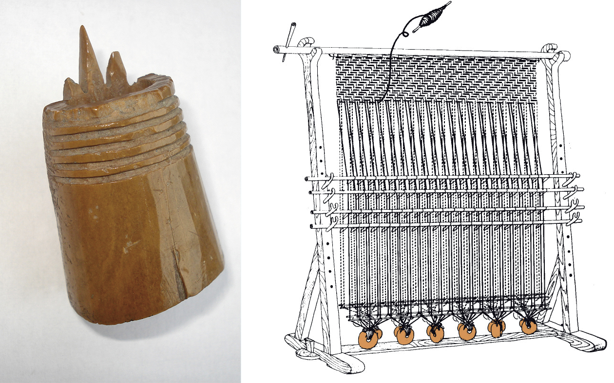
This was a community of farmers, craftspeople and traders. A three-pronged tool suggests wool processing, confirmed through microscopic analysis of wear. Loom weights found nearby indicate textile production – quiet evidence of everyday life nearly a thousand years ago.
Back to map
The Hoogstraat takes its name from its initially high elevation as a dike. The dam built across the Rotte around 1270 formed part of this structure. On its southern side lay the Steiger, Rotterdam’s oldest harbour. Locks in the Hoogstraat dam regulated water flow into the Maas, while another lock at the Delftsevaart managed shipping traffic inland.
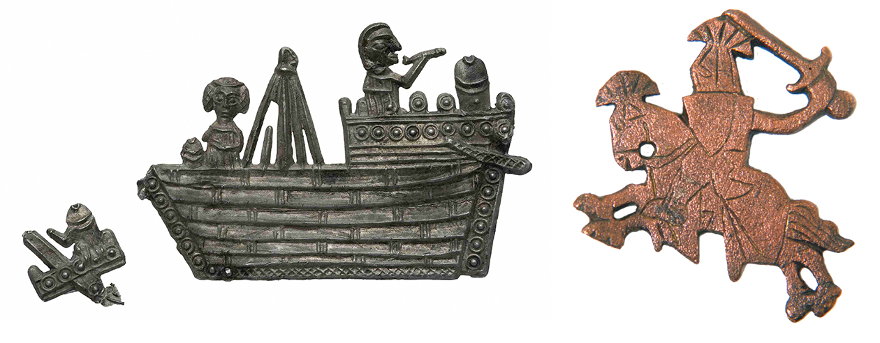
The earliest settlement in Rotterdam developed directly on this dam – about 400 metres long. By 1300, the first stone houses appeared here, built for the city’s elite. One excavation revealed a decorative copper fitting shaped like a knight on horseback.
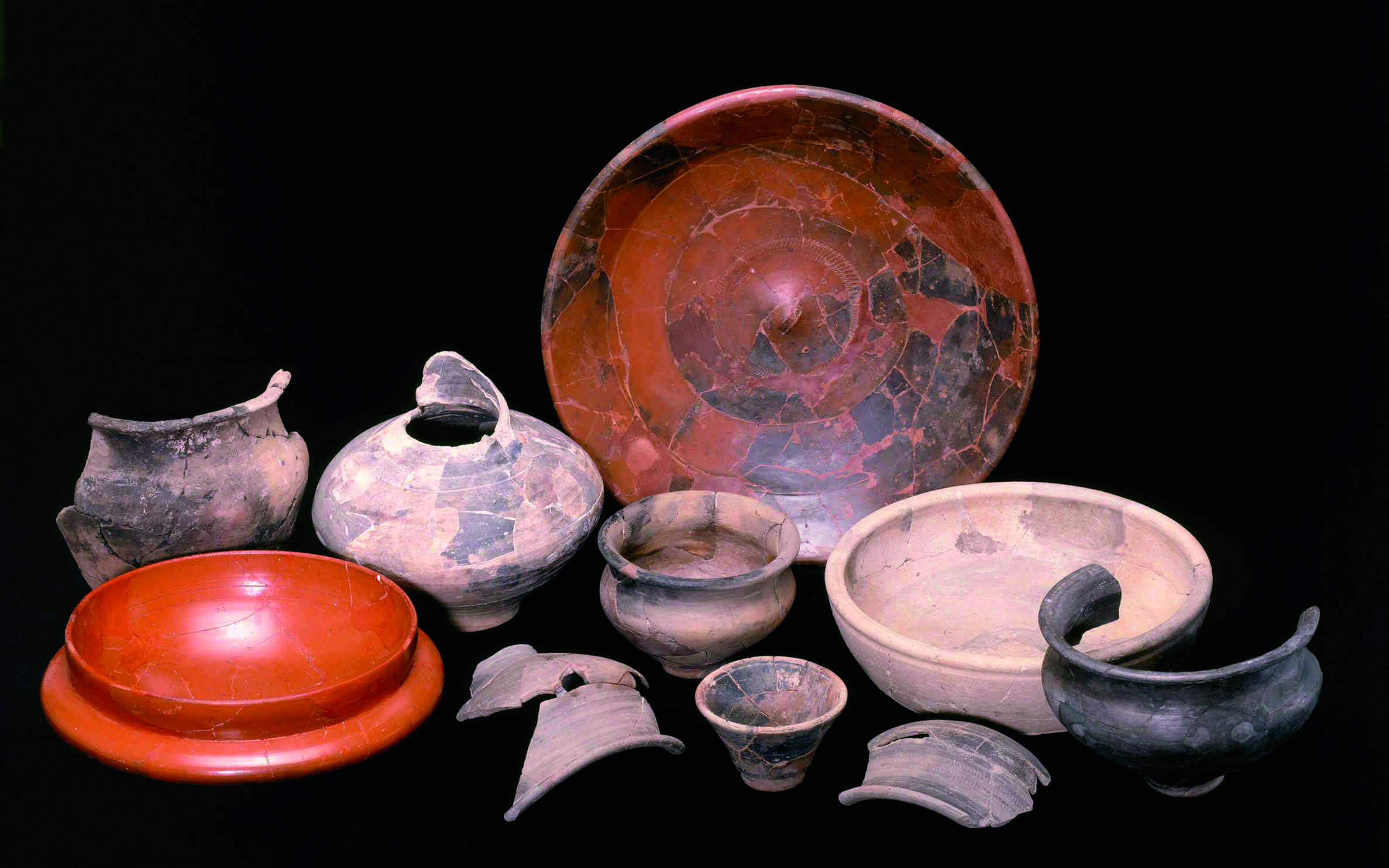
In 1990, at a depth of nine metres beneath the Hoogstraat, archaeologists also uncovered a Roman cremation grave dating to around 150 AD. Four individuals – likely a family – were cremated together: a man, a woman and two young children. The deceased were buried accompanied by pottery, food and a bronze cloak pin.
Back to map
The first written reference to the Sint-Laurenskerk dates from 1366, though virtually nothing is known about the 14th century structure or its possible predecessors. The current building largely dates to the 15th century. Excavations around the church square have revealed burials and coffins from its original cemetery.
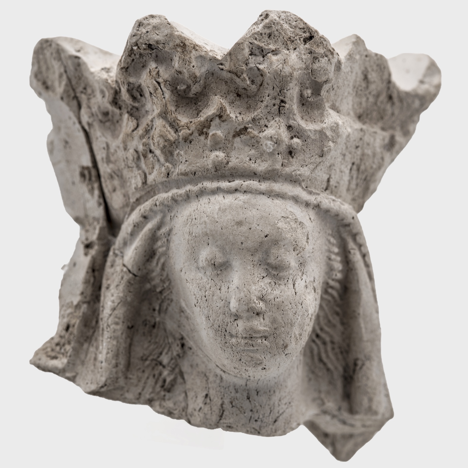
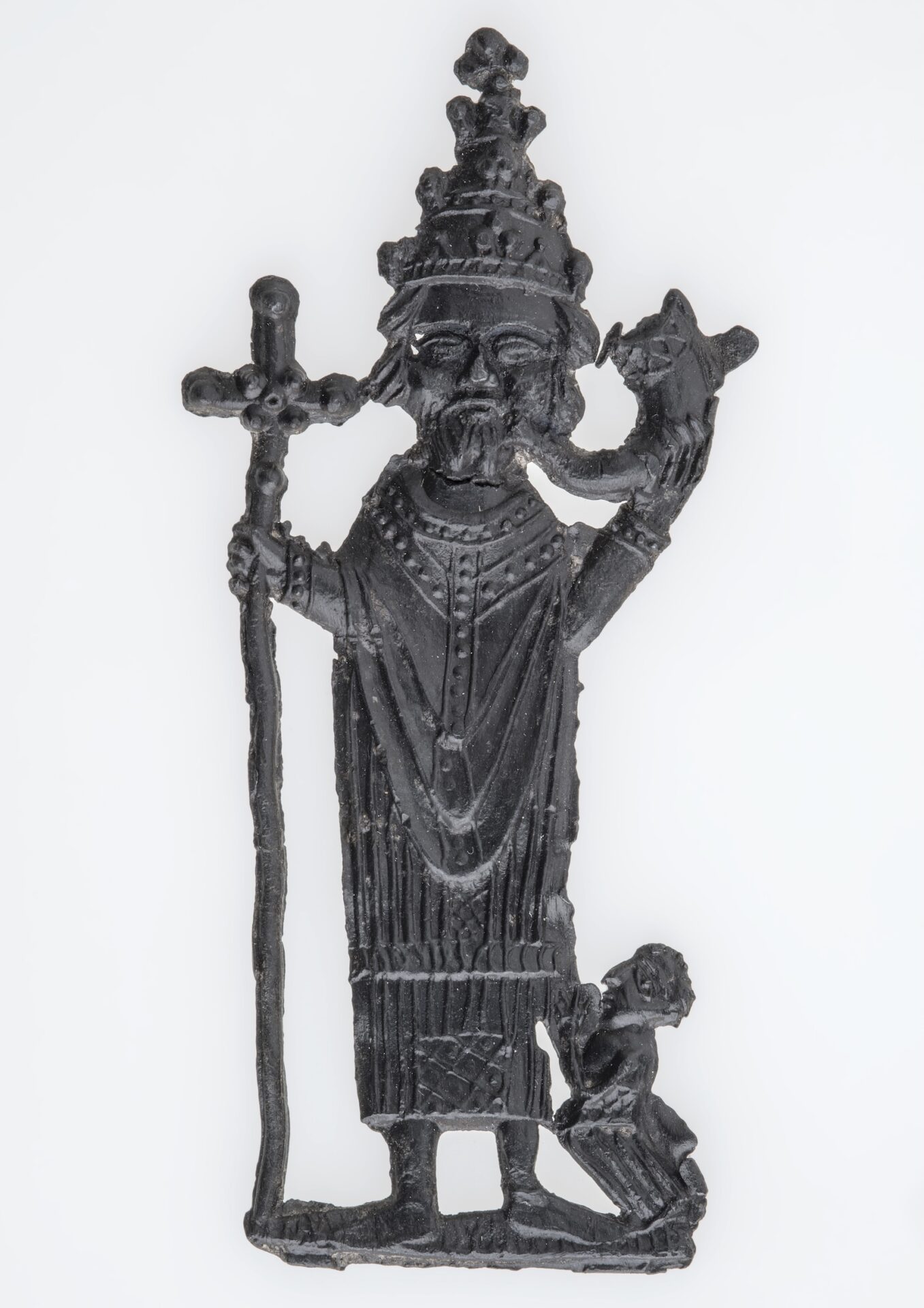
Religion played a central role in medieval Rotterdam. This is evident not only in the presence of churches and monasteries, but also in small devotional objects – religious figurines, pipe stems, and pilgrim badges brought back from sacred sites.
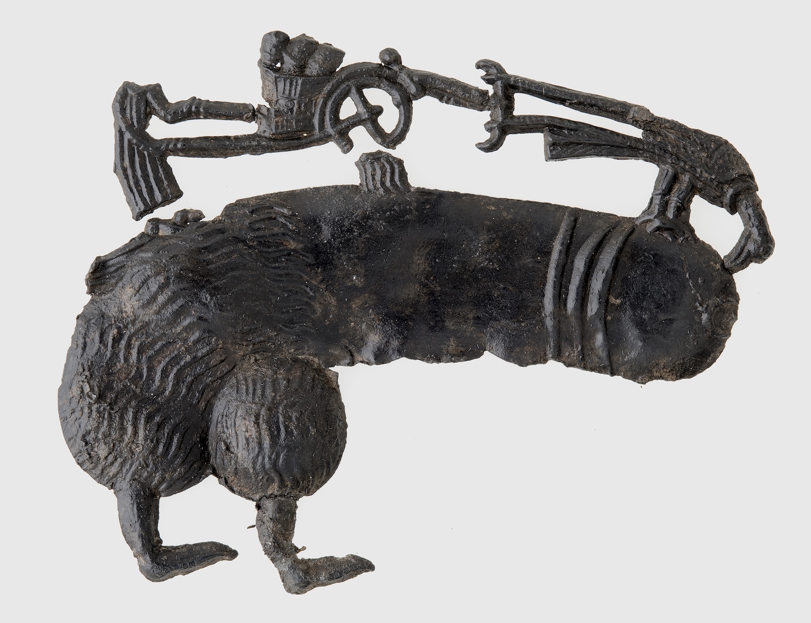
One such badge, depicting Pope Cornelius, was found near the Markthal, linking Rotterdam to pilgrimage routes as far as Ninove in Flanders, where Cornelius was venerated. Notably, some badges discovered in the city depict erotic imagery – worn in the 14th and 15th centuries.
Back to map
From around 1325 onwards, the settlement expanded beyond the Hoogstraat dam to both sides of the Rotte. At the construction site of De Hofdame, archeologists uncovered numerous medieval townhouses. Early dwellings were wooden, later replaced by brick structures from the 15th century onward. Timber frames were filled with wattle and daub (woven branches) and coated in clay, with thatched roofs overhead. Behind the houses, pits were dug for waste and animal manure.
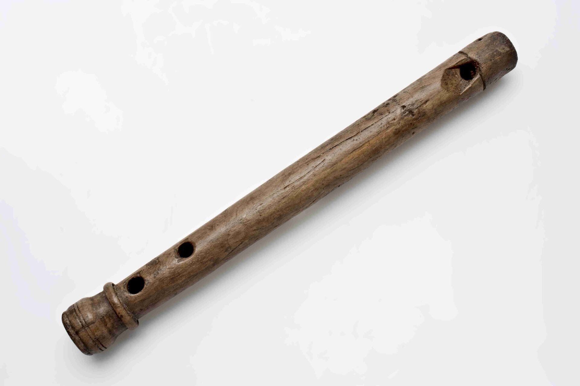
Because Rotterdam’s archaeological layers lie below the groundwater level, even organic materials such as wood and leather are often remarkably well preserved. At this site, for example, a finely crafted wooden flute from around 1500 was recovered.
Back to map
During the construction of the Timmerhuis, archaeologists discovered a dike which had sunk deep into the ground, dating from around 1200. It is the eastern dike of the Cool polder and the western dike of the Rotterdam polder, within which, following the construction of the dam, the city of Rotterdam was founded.
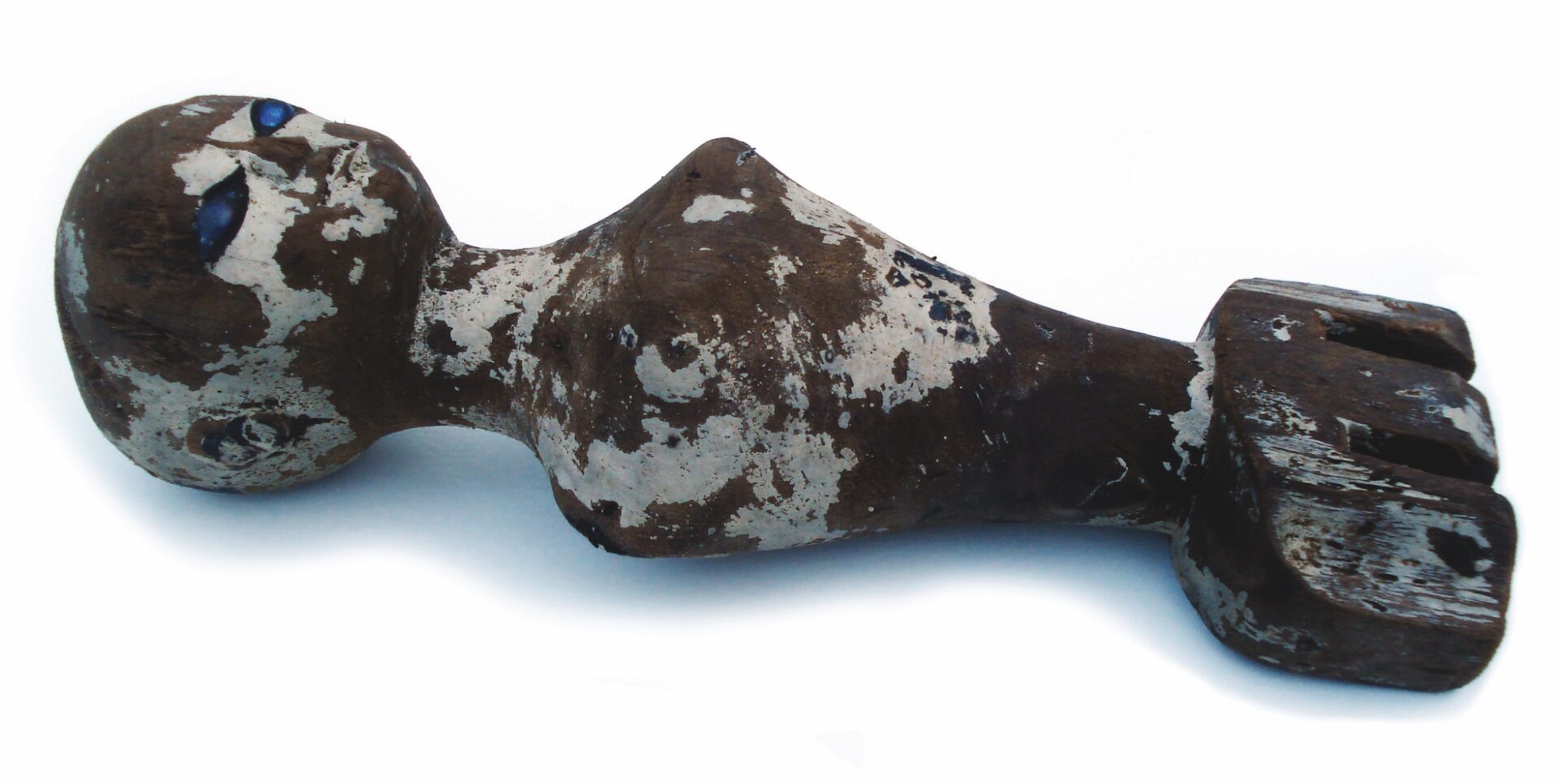
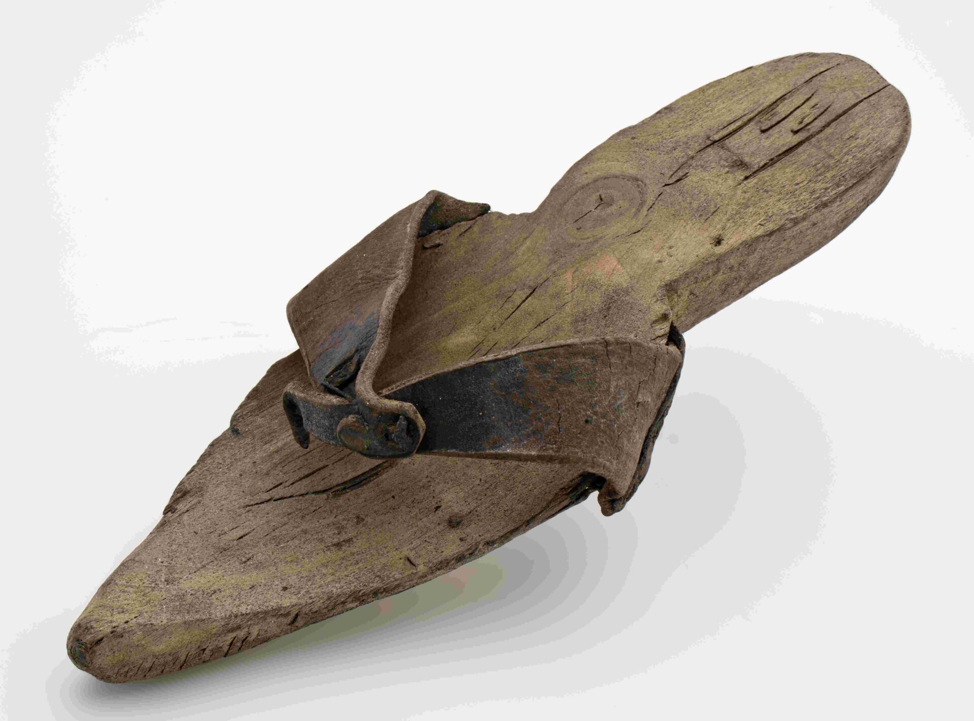
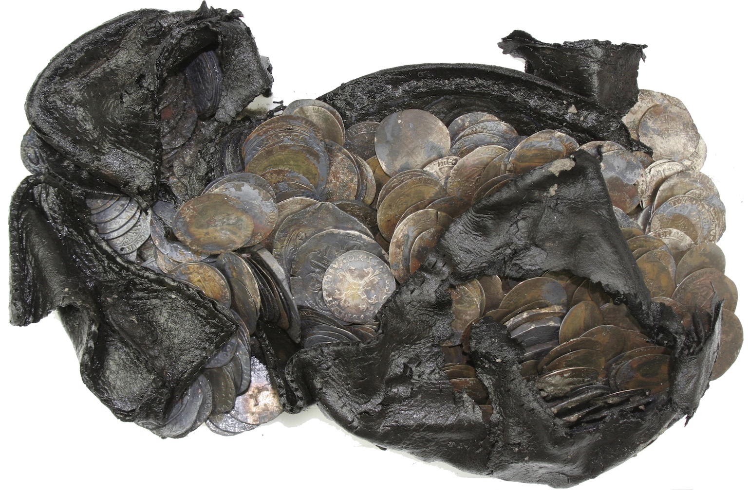
Archaeologists also uncovered waste pits belonging to the St Aechten convent, founded in 1458. After Rotterdam sided with the Protestants in 1572, the convent was confiscated and replaced by housing. The excavations revealed various house foundations and waste pits. These contained mainly domestic objects, children’s toys – including a wooden doll and a rattle that you could bite and blow – and, most remarkably, a leather shoe filled with 477 silver coins, dating from 1472 to 1592.
Back to map
Here, we leave the medieval city behind. The Delftse Poort (or Delft Gate) was reconstructed in 1995, based on a design by Cor Kraat, referencing the gate that stood here between 1772 and 1938. However, the original gate was situated further to the west.
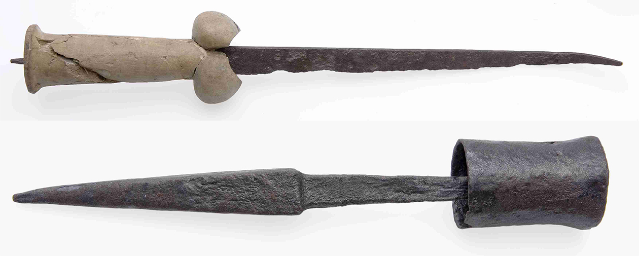
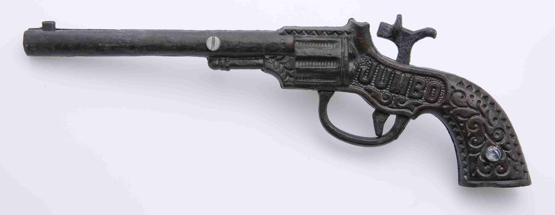
The Pompenburg once formed the northern city moat. Excavations during the railway tunnel construction uncovered not only parts of the city wall, but also objects from the bottom of the moat – including a medieval stabbing weapon known as a goedendag, a dagger from around 1500, and even a children’s toy pistol from the 1930s.
Back to map
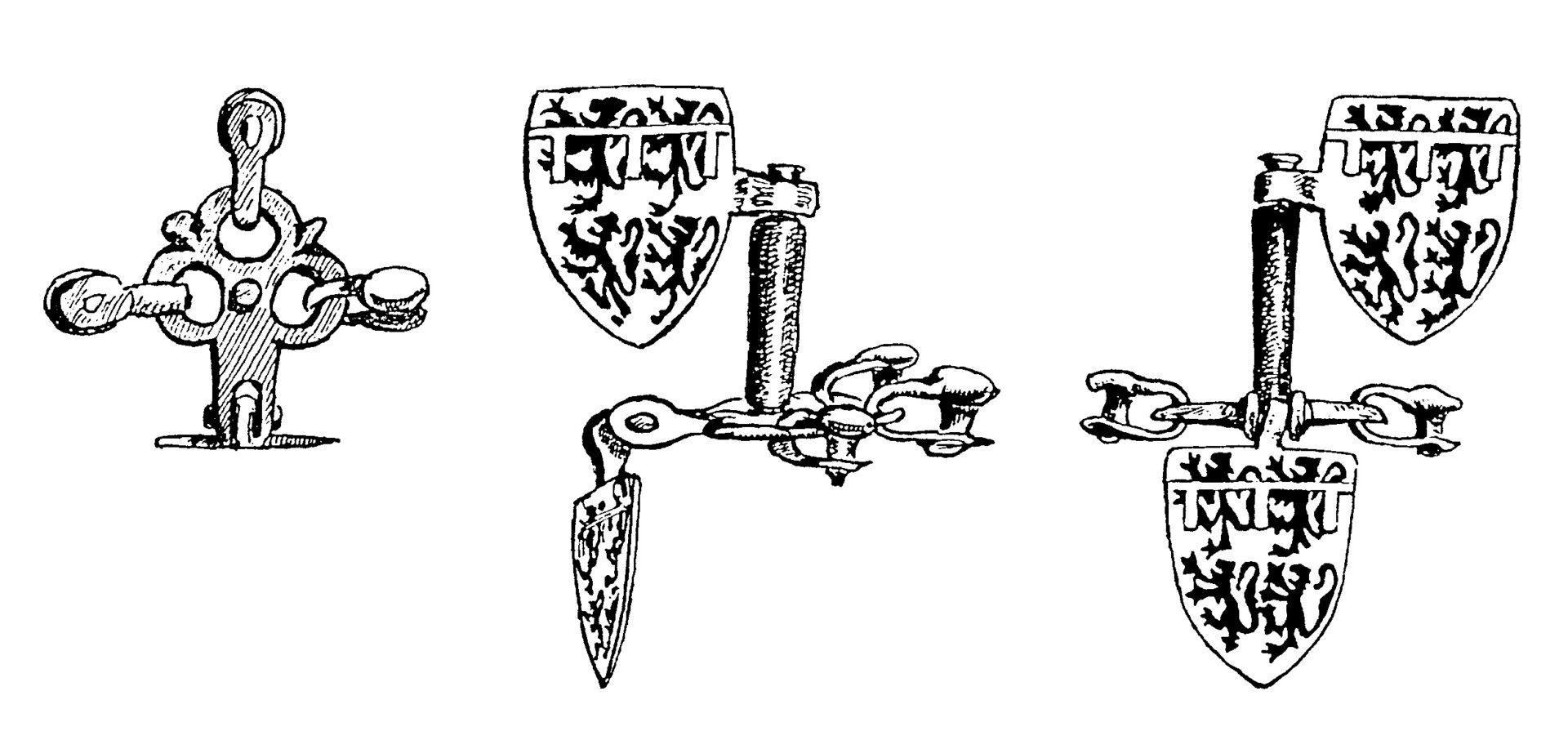
Just beyond the medieval city, beneath the former Hofplein station, at the junction of Katshoek and Hofdijk, lie the remains of Kasteel Weena castle complex. Dating from the 13th century, the castle consisted of a moated residential tower measuring ten by twelve metres. Its heavy masonry was first uncovered in 1905 during the construction of the station.
Subsequent searches for the remains of this castle were carried out in 1941 and 1990, revealing small copper coats of arms, likely from horse harnesses, bearing the arms of the counts of Holland-Hainaut. These are attributed to William IV and date to the third quarter of the 14th century.
Back to map